
In the Planado web application, you can draw territory boundaries directly on the map without preparing and uploading a GeoJSON file first.
Drawing boundaries on the map
To define a territory's boundaries, open an existing territory or create a new one under Settings → Territories.
In Boundaries, select Drawing on the map and click Draw on map.
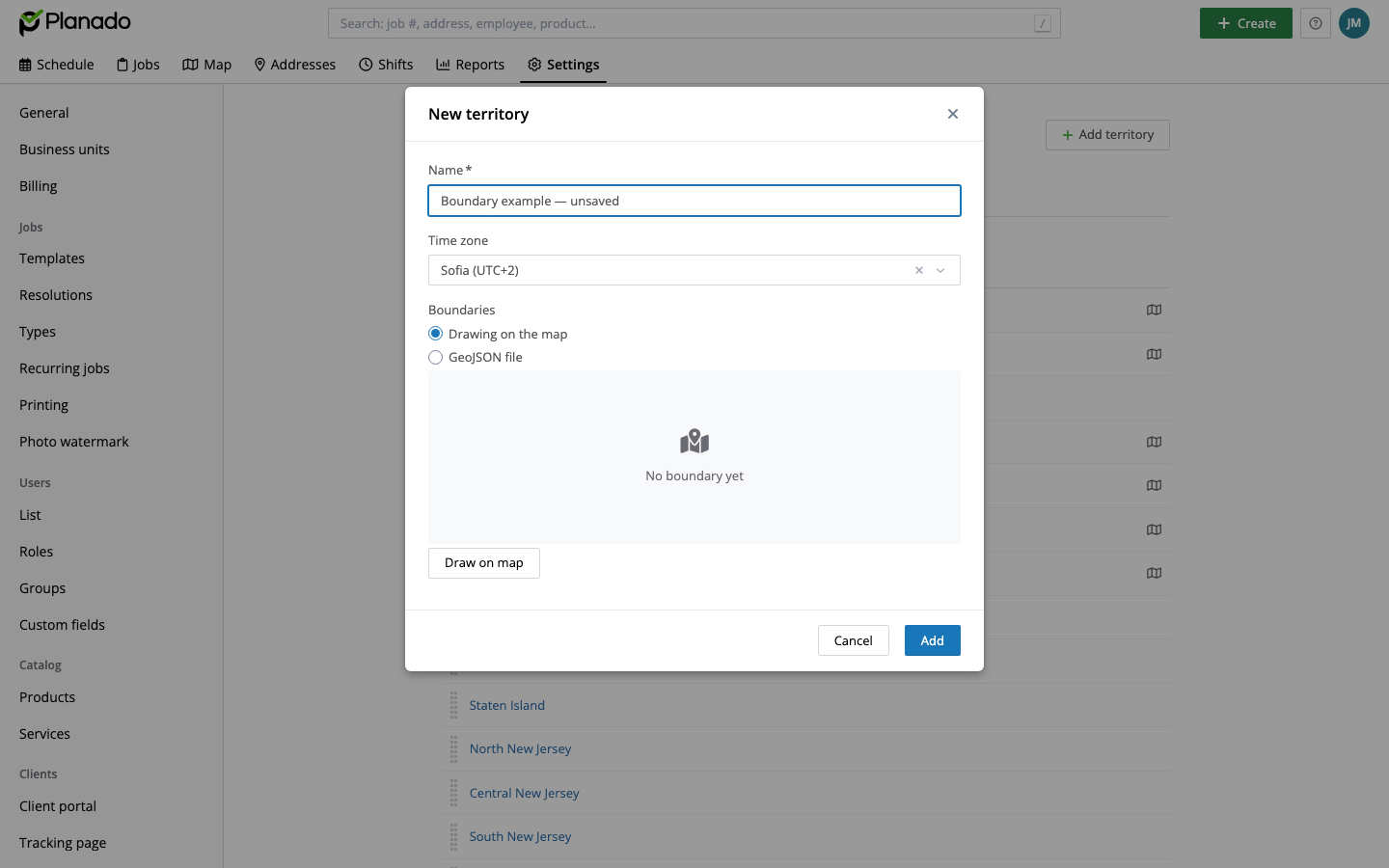
Choosing how to define the territory boundaries
A map editor opens. Click the map to mark the vertices of the territory. Double-click to finish drawing.
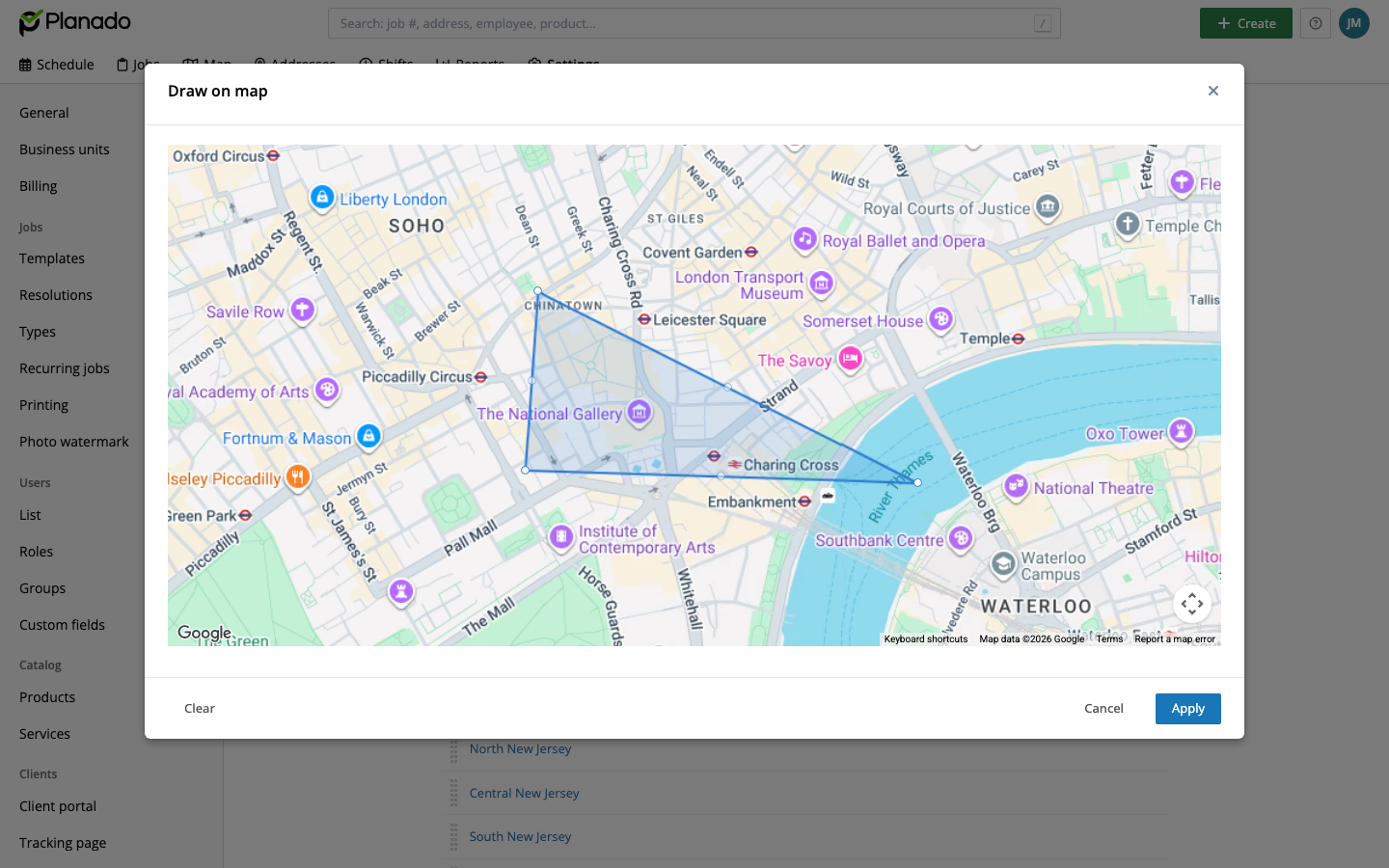
Drawing a territory boundary
While you draw, the boundaries of other existing territories appear in grey, helping you see them and avoid overlaps.
Complete the outline and click Apply.
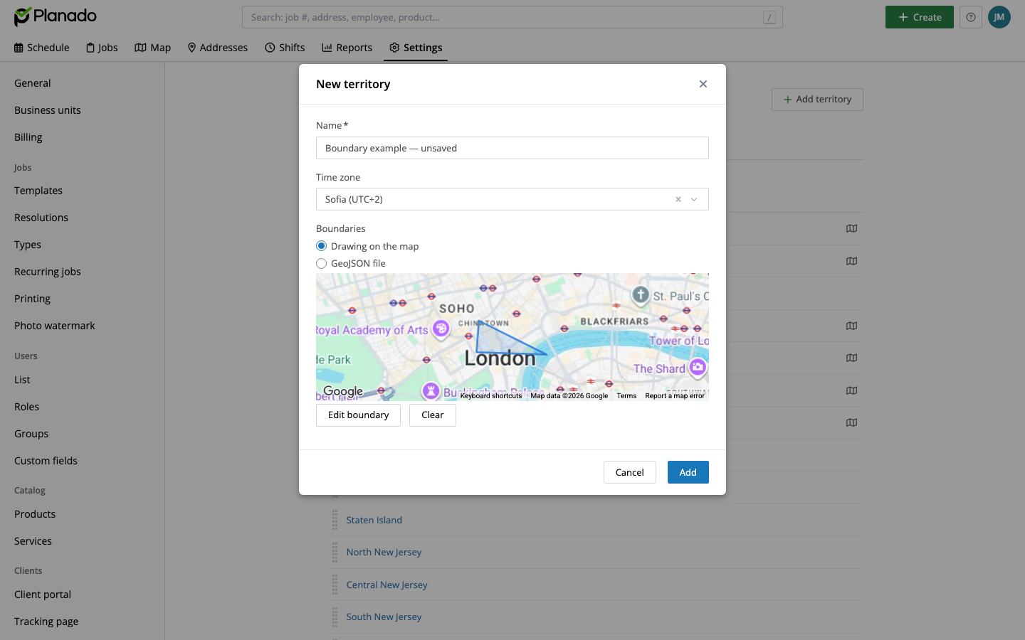
The drawing is added to the territory form
Save the territory to keep the changes. After the map drawing is saved, jobs whose addresses fall within the boundary are automatically assigned to that territory.
Converting a GeoJSON boundary to a map drawing
If a territory's boundaries were previously uploaded from a GeoJSON file, you can edit them directly in Planado.
Open the territory for editing. In Boundaries, change the source from GeoJSON file to Drawing on the map.
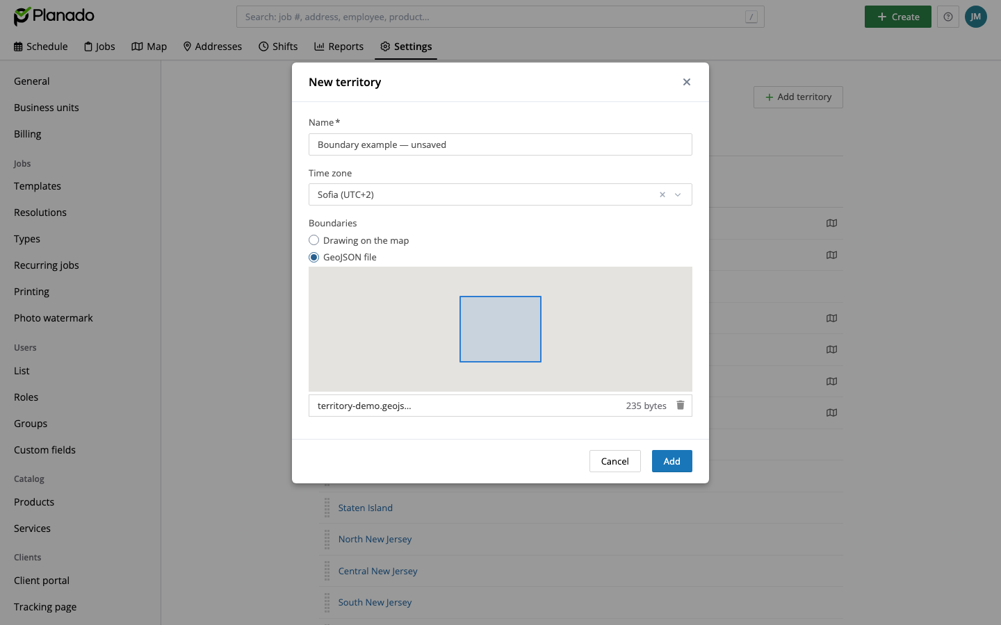
A boundary imported from GeoJSON
The outline from the current file is carried over automatically. Click Edit boundary to open it in the map editor and adjust the outline using the map tools.
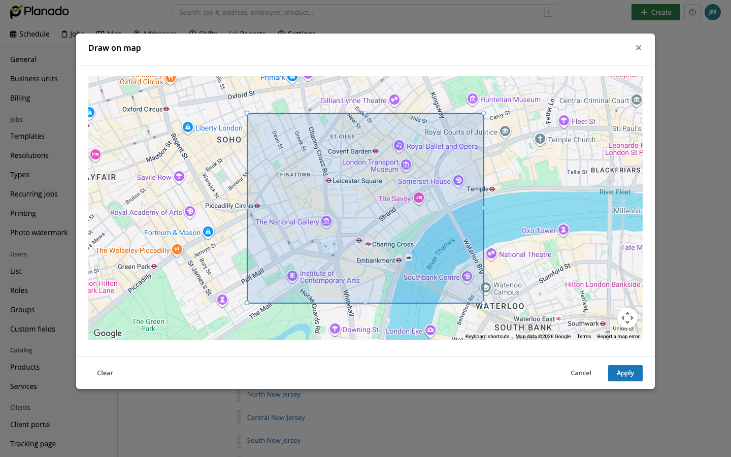
Editing the imported boundary on the map
Click Apply, then save the territory.
When you save, Planado stores the updated map boundary and automatically removes the previously attached GeoJSON file.
If you have any questions about drawing territory boundaries or other Planado features, contact us at support@planado.app.